
Products & Services
Our business is primarily structured around two divisions: Geospatial Data Engineering Services and Technology Product & Service Solutions. We provide users with aerospace remote sensing data acquisition, processing, and intelligent application services.
Data Engineering Services
End-to-end geospatial data engineering services covering aerial imagery acquisition, remote sensing product manufacturing, and natural resource surveying and monitoring applications.
Key Projects
Domestic satellite DSM, Third National Land Survey, Territorial Spatial Planning, Real Estate Registration, and other major projects
Smart Application Products
Core products include the Real-World 3D Platform, Territorial Spatial Basic Information Platform, GIS Intelligent Update Software, and fully automated DOM operations.
Data Engineering Services
Aerial imagery data acquisition
The company has been engaged in aerial imagery data acquisition for over 10 years. We possess a wide range of large-scale airborne photogrammetry equipment and UAV systems, backed by a highly skilled, experienced, and execution-driven aerial survey team. Our end-to-end workflow covers route planning, solution design, equipment operation, data processing, and quality control, establishing an integrated system for aerial imagery data acquisition.
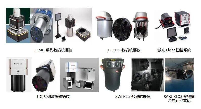
Large-scale airborne aerial photography equipment
The company offers a range of aerial imaging systems—including conventional, oblique, LiDAR, and SAR—to deliver optimal ground resolution tailored to diverse terrains and climates.
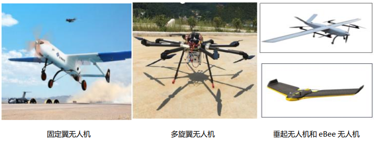
Drone System
The company provides a range of fixed-wing and multi-rotor drones. These serve as a supplement to large-aircraft aerial photography and are also ideal for small-to-medium scale photogrammetry projects, including emergency surveying, monitoring of greenhouse structures, illegal villas, and nature reserves.
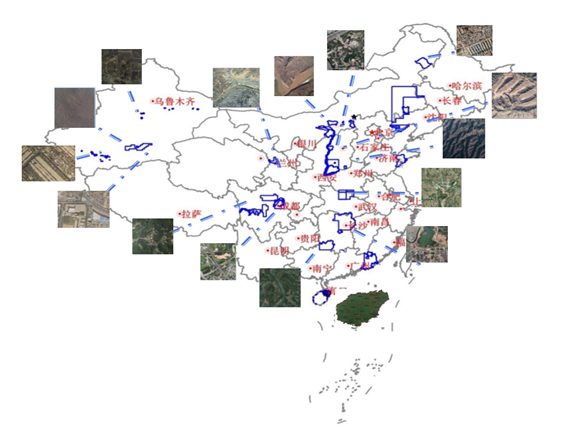
Typical Cases
Our company boasts a top-tier aerial survey team capable of swiftly, efficiently, and flexibly executing diverse survey missions. We excel in managing flight operations across varied terrains and weather conditions, with extensive experience navigating challenging airspace over southern regions and airport zones. In recent years, we have successfully completed nearly 100 aerial survey projects nationwide, covering a total area of nearly 100 square kilometers.
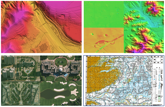
Remote Sensing Data Product Manufacturing
The company specializes in photogrammetry and remote sensing data products. With years of experience and technical expertise, we have built a skilled professional team capable of delivering end-to-end solutions for base geographic information production, real-world 3D modeling, LiDAR point cloud processing, and synthetic aperture radar (SAR) data analysis. We possess the technical strength to execute major engineering projects.
Basic Geospatial Data Production
Leveraging multi-source aerospace remote sensing imagery and advanced processing systems, we efficiently produce standardized and customized products including DSM, DEM, DOM, and DLG at scales from 1:500 to 1:50000. We have already delivered the nation's first high-precision, high-fidelity 10-meter DSM dataset.
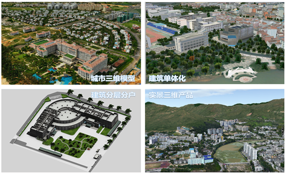
Real-world 3D Product Production
Combining oblique photography with traditional photogrammetry, we use cluster processing to create large-scale 3D real-world models. Through advanced refinement, we produce detailed individual models, floor-by-floor and unit-level models, and BIM models. By integrating high-fidelity DSMs with high-resolution DOMs and urban 3D models, we build real-world 3D application scenarios that provide essential 3D data support for digital twin cities, natural resource rights registration, specialized surveys, emergency response, and industry-specific applications.
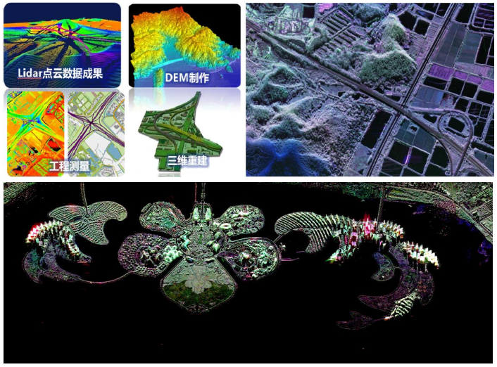
Lidar and SAR data processing
Leveraging domestic leading data processing platforms, this solution rapidly processes LiDAR and SAR data to support natural resource surveys, forest inventories, marine resource assessments, and agricultural, forestry, and water conservation censuses.
Natural Resource Survey and Monitoring Application
Our company serves the natural resources, ecological environment, and agriculture, forestry, and water conservancy sectors, providing long-term professional integrated field and office survey monitoring application services in areas such as natural resource survey and monitoring, real property rights confirmation and registration, and territorial spatial planning.
Natural Resources Survey and Monitoring
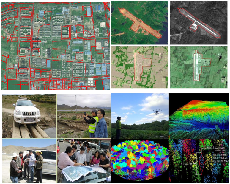
The company operates a mature survey and monitoring business system with a professional service team. Leveraging interpretation and analysis of multi-source remote sensing data, we deliver comprehensive services—including surveys, monitoring, database construction, data analysis, and application of results—for natural resources such as land, minerals, forests, grasslands, water bodies, wetlands, and coastal seas/islands. We provide technical support and applied services for specialized investigations including dynamic land use monitoring, illegal land use detection, human activity monitoring in nature reserves, and forest resource inventories. In the Third National Land Survey project, the company executed nearly 30 tasks covering national, provincial, municipal, and county levels.
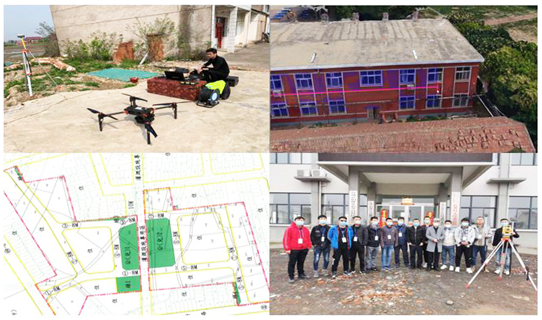
Real Estate Title Registration
Leverage advanced technologies including oblique photogrammetry, cluster-based automated 3D modeling, and naked-eye 3D surveying. Building on existing homestead investigation results and registration data, we will verify original homesteads within the project area, conduct property rights surveys for existing houses, and perform integrated real estate and land surveys for newly established rural homesteads. This process establishes a comprehensive integrated real estate and land survey database, digitizes paper records, and links them to the basic platform for immovable property registration information management. Finally, we will complete rural immovable property rights confirmation and registration, issuing official title certificates.
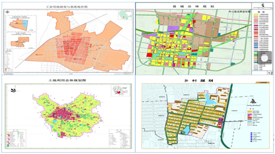
Territorial Spatial Planning
Built on the National Spatial Infrastructure Platform, this solution leverages next-generation technologies such as cloud computing and big data to integrate diverse spatially linked current status and professional datasets. Centered on modernizing spatial governance capabilities, it supports land and space planning—including preparation, approval, implementation, monitoring, and evaluation—to help natural resources management departments achieve their overarching goals of unified blueprint management ("one map for all") and modernized spatial governance.
Key Projects
Demonstration of Comprehensive Application Services for Geographic Condition Information Based on Domestic Satellites
In collaboration with the Satellite Remote Sensing Application Center of the Ministry of Natural Resources, we utilized Resource-3 satellite imagery as our primary data source and deployed our domestically developed, self-designed satellite DSM rapid processing system. Leveraging automated matching and automatic terrain feature extraction technologies, we produced China's first set of high-fidelity Digital Surface Model (DSM) data products at a 15-meter grid resolution nationwide, filling a critical gap in domestic high-precision elevation data. Notably, the project "Key Technology R&D and Industrialization of National 15-meter Grid DSM" was awarded the Special Prize for Surveying and Mapping Science and Technology Progress in 2016.
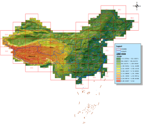
National 15 m Mesh High-Precision Digital Surface Model (DSM) Data Product
Third National Land Survey
Between 2018 and 2019, the company undertook nearly 30 projects related to the Third National Land Survey, including county-level surveys, city-level supervision and consolidation, provincial-level supervision, and national-level survey tasks (off-site verification, field verification, database inspection, and data submission). By the end of 2019, the survey phase was completed with unanimous approval from clients; more than ten projects received formal commendation letters.
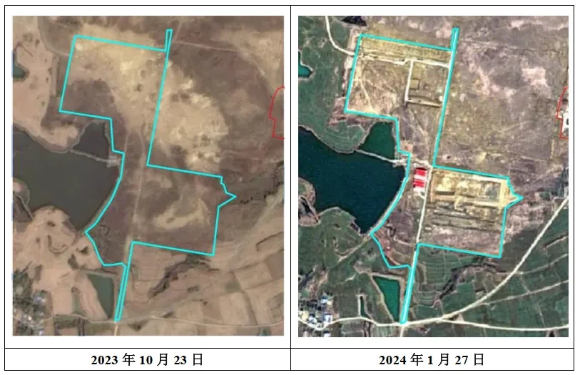
Satellite image monitoring for land parcel change detection, supporting land surveys and routine updates.
Territorial Spatial Planning
Build a "one-map" system for territorial spatial planning by leveraging natural resource survey and monitoring data, adhering to national unified surveying and mapping standards. Integrate diverse spatial datasets required for planning—including remote sensing imagery, land surveys, and geographic condition census—overlay them with urban master plans, detailed control plans, and overall land use plans at all levels, and share socio-economic information related to territorial spatial planning.
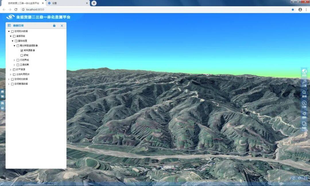
3D Integrated Monitoring Scenario for the National Spatial Infrastructure Platform
Real Estate Project
Leveraging advanced technologies such as UAV oblique photogrammetry, automated 3D modeling, and naked-eye 3D mapping, we address key challenges in traditional real estate surveying—including high labor costs, extensive fieldwork, elevated expenses, and complex workflows. We have developed an integrated solution that combines automated computer data processing with conventional surveying methods, enabling nationwide real estate rights confirmation and registration.
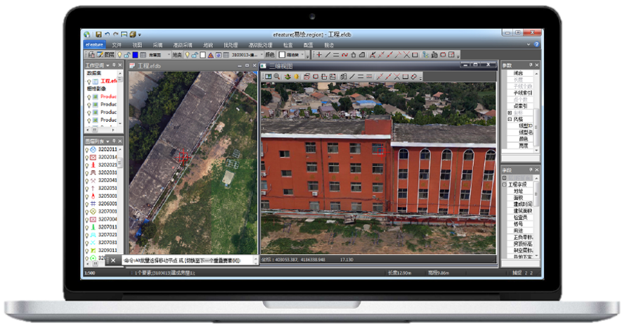
3D Intelligent Surveying Software Supports Integrated Land and Building Mapping
Smart Application Products
In the realm of smart application services, we offer users a range of core products. For detailed text and image descriptions, visit High-Tech Products & Services.